Newton, Massachusetts | |
|---|---|
| City of Newton | |
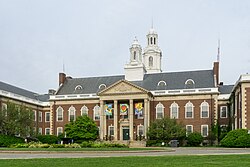
 City Hall | |
| Nickname: "The Garden City" | |
| Motto(s): "Liberty and Union" | |
 Location in Middlesex County, Massachusetts | |
| Coordinates: 42°20′13″N 71°12′35″W / 42.33694°N 71.20972°W | |
| Country | United States |
| State | Massachusetts |
| County | Middlesex |
| Settled | 1630 |
| Incorporated (Town) | 1681 |
| Incorporated (City) | 1874 |
| Government | |
| • Type | Mayor–council |
| • Mayor | Ruthanne Fuller[1] |
| Area | |
• Total | 18.16 sq mi (47.03 km2) |
| • Land | 17.83 sq mi (46.17 km2) |
| • Water | 0.33 sq mi (0.86 km2) |
| Elevation | 100 ft (30 m) |
| Population (2020) | |
• Total | 88,923 |
| • Density | 4,987.83/sq mi (1,925.84/km2) |
| Time zone | UTC−5 (Eastern) |
| • Summer (DST) | UTC−4 (Eastern) |
| ZIP Codes | 02458–02462, 02464–02468 |
| Area code | 617/857 |
| FIPS code | 25-45560 |
| GNIS feature ID | 0617675 |
| Website | www.newtonma.gov |
Newton is a city in Middlesex County, Massachusetts, United States. It is roughly 8 miles (13 km) west of downtown Boston, and comprises a patchwork of thirteen villages. The city borders Boston to the northeast and southeast (via the neighborhoods of Brighton and West Roxbury), Brookline to the east, Watertown and Waltham to the north, and Weston, Wellesley, and Needham to the west. At the 2020 U.S. census, the population of Newton was 88,923.[3]
Newton is home to the Charles River, Crystal Lake, and Heartbreak Hill, among other landmarks. It is served by several streets and highways (including Route 9, Hammond Pond Parkway, and the Mass Pike), as well as the Green Line D branch run by the MBTA.
Historically, the area that is now Newton was settled in 1639, and was originally first part of Cambridge (then called "the newe towne"). It split from Cambridge in 1681, and became known by its present name of Newton in 1766. It then became a city in 1874.
- ^ Levin, Andy. "Ruthanne Fuller sworn in as Newton's mayor". Newton TAB. Archived from the original on January 2, 2018. Retrieved January 2, 2018.
- ^ "2020 U.S. Gazetteer Files". United States Census Bureau. Retrieved May 21, 2022.
- ^ "U.S. Census Bureau Quickfacts: United States". United States Census Bureau. Retrieved September 16, 2021.


