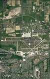
Niagara Falls International Airport | |||||||||||||||||||
|---|---|---|---|---|---|---|---|---|---|---|---|---|---|---|---|---|---|---|---|
 | |||||||||||||||||||
 | |||||||||||||||||||
| Summary | |||||||||||||||||||
| Airport type | Public / military | ||||||||||||||||||
| Owner/Operator | Niagara Frontier Transportation Authority | ||||||||||||||||||
| Location | Town of Niagara, Town of Wheatfield, Niagara County, near Niagara Falls, New York | ||||||||||||||||||
| Elevation AMSL | 592 ft / 180 m | ||||||||||||||||||
| Coordinates | 43°06′26″N 78°56′46″W / 43.10722°N 78.94611°W | ||||||||||||||||||
| Website | www | ||||||||||||||||||
| Maps | |||||||||||||||||||
 FAA airport diagram | |||||||||||||||||||
 | |||||||||||||||||||
| Runways | |||||||||||||||||||
| |||||||||||||||||||
| Statistics (2017) | |||||||||||||||||||
| |||||||||||||||||||
Aircraft operations data for 2011; Sources: Federal Aviation Administration,[1] NFTA Press Release,[2] Bureau of Transportation Statistics[3] | |||||||||||||||||||
Niagara Falls International Airport (IATA: IAG, ICAO: KIAG, FAA LID: IAG) is located 4 mi (6.4 km) east of downtown Niagara Falls, in the Town of Niagara in Niagara County, New York, United States.[1] Owned and operated by the Niagara Frontier Transportation Authority, the airport is a joint civil-military airfield and shares its runways with the Niagara Falls Air Reserve Station. A new terminal building opened in 2009. It is notable for serving vastly more Canadian passengers from over the nearby border than Americans.
- ^ a b FAA Airport Form 5010 for IAG PDF, effective May 16, 2024.
- ^ NFTA. "Niagara Falls International Airport". www.niagarafallsairport.com.
- ^ Niagara Falls International (IAG) at transtats.bts.gov, Retrieved April 24, 2015