Niamey
| |
|---|---|
| Names transcription(s) | |
| • Zarma | ٽَمَيْ |
| • Hausa | یَمَیْ یَمَیْ |
| • Tawallammat | ⵏⵉⵎⵢ نِيامِيْ |
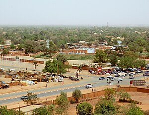
Niamey from grand mosque, Trois Sœurs, Place du Temple, Zoo du Musée national de Niamey, Kountché Stadium, Dunes | |
 Capital of Niger | |
| Coordinates: (City Hall of Niamey) 13°30′49″N 02°06′32″E / 13.51361°N 2.10889°E | |
| Country | |
| Region | Niamey Urban Community |
| Communes Urbaines | 5 Communes |
| Districts | 44 Districts |
| Quartiers | 99 Quarters |
| Government | |
| • Type | Appointed district government, elected city council, elected commune and quarter councils[2] |
| • Mayor | Assane Seydou Sanda[2] |
| Area | |
| • Total | 239.30 km2 (92.39 sq mi) |
| Elevation | 207 m (679 ft) |
| Population (2012) | |
| • Total | 1,026,848[1] |
| • Estimate (October 1, 2020) | 1,334,984[3] |
| Niamey Urban Community | |
| Time zone | UTC+01:00 (West Africa Time) |
| • Summer (DST) | (Not Observed) |
| Area code | 20 |
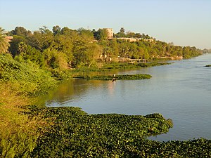
Niamey (French pronunciation: [njamɛ]) is the capital and largest city of Niger. Niamey lies on the Niger River, primarily situated on the east bank. Niamey's population was counted as 1,026,848 as of the 2012 census. As of 2017, population projections show the capital district growing at a slower rate than the country as a whole, which has the world's highest fertility rate.[4] The city is located in a pearl millet growing region, while manufacturing industries include bricks, ceramic goods, cement, and weaving.[citation needed]
- ^ National Statistics Institute of Niger. "Structure of the Population RGPH 2012" (PDF). Retrieved 31 December 2020.
- ^ a b Assane Seydou Sanda-elu-maire-de-la-ville-de-niamey&catid=34:actualites&Itemid=53 Installation du Conseil de ville de Niamey et élection des membres : M. Assane Seydou Sanda, élu maire de la ville de Niamey. Laouali Souleymane, Le Sahel (Niamey). 1 July 2011
- ^ National Statistics Institute of Niger. "Demographic Projections for Niger 2012-2024". Retrieved 31 December 2020.
- ^ "Niger: Regions, Departments, Communes, Cities, Localities and Municipal Arrondissements - Population Statistics in Maps and Charts". citypopulation.de.


