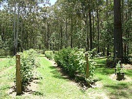
| Niangala New South Wales | |
|---|---|
 Koolkuna Berry Farm | |
| Coordinates | 31°17′54″S 151°24′34″E / 31.29833°S 151.40944°E |
| Population | 142 (2011 census)[2] |
| Postcode(s) | 2354 |
| Elevation | 1,300 m (4,265 ft) |
| Time zone | AEST (UTC+10) |
| • Summer (DST) | AEDT (UTC+11) |
| Location | |
| LGA(s) | |
| Region | New England Hunter[4] |
| County | Parry[5] |
| Parish | Walcha[5] |
| State electorate(s) | Tamworth[6] |
| Federal division(s) | |

Niangala is a village located on the south-eastern edge of the Northern Tablelands area of New South Wales, Australia. It is on the Moonbi Range which is part of the Great Dividing Range, at approximately 1,300 metres (4,265 ft) above sea level. The village is in Walcha parish in Parry County.[9] At the 2011 census, Niangala and the surrounding area had a population of 142.[2]
Geographically isolated, the village is situated among pine tree plantations. Access to the community requires travel along some stretches of dirt road, which can be hazardous in wet or snow conditions. Winters are cold there, often with several falls of snow during the season.
Niangala, meaning ‘eclipse’, was first known as Bungadore, ‘blackrocks’ and is situated at the head of Bungendore Creek.
- ^ "Suburb Search - Local Council Boundaries - Northern (NR) - Tamworth Regional Council". New South Wales Division of Local Government. Archived from the original on 7 May 2006. Retrieved 5 January 2010.
- ^ a b Australian Bureau of Statistics (31 October 2012). "Niangala (State Suburb)". 2011 Census QuickStats. Retrieved 9 April 2015.
- ^ "Suburb Search - Local Council Boundaries - Northern (NR) - Walcha Council". New South Wales Division of Local Government. Archived from the original on 27 August 2001. Retrieved 5 January 2010.
- ^ a b "Suburb Search - Local Council Boundaries - Hunter (HT) - Upper Hunter Shire". New South Wales Division of Local Government. Retrieved 5 January 2010.
- ^ a b "Niangala". Geographical Names Register (GNR) of NSW. Geographical Names Board of New South Wales. Retrieved 5 January 2010.
- ^ "Tamworth". New South Wales Electoral Commission. Retrieved 23 November 2019.
- ^ "New England". Australian Electoral Commission. 24 September 2009. Retrieved 5 January 2010.
- ^ "Hunter". Australian Electoral Commission. 24 September 2009. Archived from the original on 24 October 2009. Retrieved 5 January 2010.
- ^ Niangala Topographic Map 9135-2-N, 1:25,000 First Edition, CMA, NSW, 1985
