Nicoya | |
|---|---|
 | |
 | |
| Coordinates: 10°06′22″N 85°29′10″W / 10.1061593°N 85.486153°W | |
| Country | |
| Province | Guanacaste Province |
| Canton | Nicoya Canton |
| Founded | 1523 |
| Joined Republic of Costa Rica | 1824-1825 |
| Government | |
| • Mayor | Eduardo Gutiérrez Rosales |
| Area | |
| • Total | 310.61 km2 (119.93 sq mi) |
| Elevation | 123 m (404 ft) |
| Highest elevation | 123 m (404 ft) |
| Lowest elevation | 3 m (10 ft) |
| Population (2011) | |
| • Total | 24,833 |
| • Density | 80/km2 (210/sq mi) |
| Time zone | UTC−06:00 |
| Postal code | 50201 |
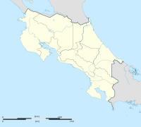
Nicoya is a district and head city of the Nicoya canton, in the Guanacaste province of Costa Rica, located on the Nicoya Peninsula.[2][3] It is one of the country's most important tourist zones; it serves as a transport hub to Guanacaste's beaches and national parks.
- ^ a b Cite error: The named reference
CR2021was invoked but never defined (see the help page). - ^ "Declara oficial para efectos administrativos, la aprobación de la División Territorial Administrativa de la República N°41548-MGP". Sistema Costarricense de Información Jurídica (in Spanish). 19 March 2019. Retrieved 26 September 2020.
- ^ División Territorial Administrativa de la República de Costa Rica (PDF) (in Spanish). Editorial Digital de la Imprenta Nacional. 8 March 2017. ISBN 978-9977-58-477-5.
