| Nidderdale National Landscape | |
|---|---|
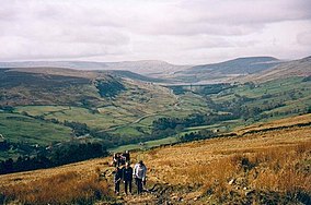
 Upper Nidderdale and Great Whernside | |
 Location of the Nidderdale AONB in England | |
| Location | North Yorkshire, England |
| Nearest town | Harrogate |
| Coordinates | 54°05′12″N 1°45′28″W / 54.086688°N 1.757728°W |
| Area | 233 sq mi (600 km2) |
| Established | 1994 |
| Website | http://www.nidderdaleaonb.org.uk |
The Nidderdale National Landscape is an Area of Outstanding Natural Beauty in North Yorkshire, England, bordering the Yorkshire Dales National Park[1] to the east and south. It comprises most of Nidderdale itself, part of lower Wharfedale, the Washburn valley and part of lower Wensleydale, including Jervaulx Abbey and the side valleys west of the River Ure. It covers a total area of 233 square miles (600 km2).[2] The highest point in the Nidderdale AONB is Great Whernside, 704 metres (2,310 ft) above sea level, on the border with the Yorkshire Dales National Park.
The area is said to contain "remains from over 6,000 years of human activity"; there is evidence of "almost continuous settlement over this time with the exception of the Roman period for which evidence is scanty".[3]
According to the AONB, the area "is home to a diverse range of wildlife, important habitats and over 16,000 people".[4] The only town within the AONB is Pateley Bridge in Nidderdale, one of the Yorkshire Dales. Otley and Ilkley lie just to the south of the AONB, and Masham and Ripon are just to the east.