 | |
| Location | Amsterdam, Netherlands |
|---|---|
| Postal code | 1012 LZ, MA-ME, MG, MH, ML, MN, MP, MR-MT, MV, MX |
| Coordinates | 52°22′33.29″N 4°53′43.19″E / 52.3759139°N 4.8953306°E |
| Other | |
| Website | http://nieuwendijk.nl |
The Nieuwendijk is a major shopping street in central Amsterdam. There are some 200 shops along the street.[1] The street, which dates to the early medieval history of Amsterdam, counts 98 buildings with rijksmonument status.[2]
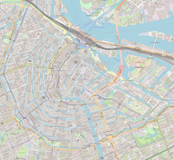
The Nieuwendijk runs northeast from Dam Square, then turns left near Prins Hendrikkade. It then heads northwest, crossing the broad street Nieuwezijds Voorburgwal at Martelaarsgracht, until it hits the Singel canal, where it continues westwards as the Haarlemmerstraat. The Nieuwendijk is part of a medieval street pattern intersected by a multitude of narrow alleys. Nine alleys run between Nieuwendijk and Damrak, seven run between Nieuwendijk and Nieuwezijds Voorburgwal, and three further alleys run west and east from Nieuwendijk beyond Martelaarsgracht.
The Korte Nieuwendijk ("short Nieuwendijk"), the westernmost part between Martelaarsgracht and Singel, was pedestrianised in the 1970s. In 2013, the entire street was pedestrianised.[3][4]
- ^ Nieuwendijk (Dutch)
- ^ Rijksmonumentenregister, Rijksdienst voor het Cultureel Erfgoed (Dutch)
- ^ "Nieuwendijk wordt voetgangersdomein", Reformatorisch Dagblad, 10 April 1971 (Dutch)
- ^ "Verkeersbesluit Kalverstraat/Nieuwendijk", Gemeente Amsterdam, 25 November 2013, Staatscourant 2013, 33898 (Dutch)
