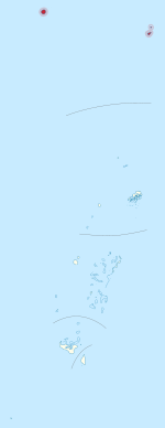
 Location of Niua Islands in Tonga | |
 | |
| Geography | |
|---|---|
| Location | Pacific Ocean |
| Coordinates | 15°58′S 173°47′W / 15.967°S 173.783°W |
| Archipelago | Tonga Islands |
| Total islands | 3 |
| Major islands | 2 |
| Area | 71.69 km2 (27.68 sq mi) |
| Highest elevation | 560 m (1840 ft) |
| Highest point | Piu 'o Tafahi |
| Administration | |
Tonga | |
| Largest settlement | Hihifo, Niuatoputapu |
| Demographics | |
| Population | 1,150[1] (2021) |
| Pop. density | 23.01/km2 (59.6/sq mi) |
| Ethnic groups | Tongan |
Niua is a division of the Kingdom of Tonga, namely the northernmost group of islands. It consists of three islands (Niuafoʻou, Niuatoputapu and Tafahi) which together have an area of 71.69 km2 and a population of 1,150. The largest village is Hihifo on Niuatoputapu. Piu'o Tafahi is the highest point with an elevation of 560 m.


- ^ "Tonga's population drops to 100,209". Matangi Tonga. 24 December 2021. Archived from the original on 24 December 2021. Retrieved 24 December 2021.