Nof HaGalil
| |
|---|---|
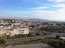
 View of Nof HaGalil | |
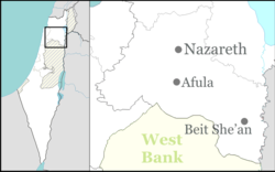
| Coordinates: 32°43′N 35°20′E / 32.717°N 35.333°E | |
| Country | |
| District | Northern |
| Founded | 1957 |
| City Status | 1974 |
| Government | |
| • Mayor | Ronen Plot |
| Area | |
• Total | 32,521 dunams (32.521 km2 or 12.556 sq mi) |
| Population (2022)[1] | |
• Total | 44,184 |
| • Density | 1,400/km2 (3,500/sq mi) |
| Ethnicity | |
| • Jews | 51.6% |
| • Arabs | 28.7% |
| • Others | 19.7% |
| Name meaning | View of Galilee |
| Website | www |
| ^ From 1957 to 2019 | |
Nof HaGalil[2] (Hebrew: נוֹף הַגָּלִיל, lit. 'View of Galilee'; Arabic: الناصرة العليا, romanized: An-Nāṣira al-‘ulyā, Arabized Hebrew: نوف هچليل) is a city in the Northern District of Israel with a population of 44,184.[1]
Nof HaGalil was founded in 1957 as Nazareth Illit (Hebrew: נָצְרַת עִלִּית, romanized: Natzrat Ilit; Arabic: الناصرة العليا, romanized: An-Nāṣira al-‘ulyā, lit. 'Upper Nazareth'), it was planned as a Jewish town overlooking the city of Nazareth and the Jezreel Valley.[3] In 1963, it was declared a local council, and in 1974, it formally gained the status of a city. Following the collapse of the Soviet Union, the city saw a large influx of Jewish immigrants from the former Soviet republics, which doubled the city's population and made it one of the centers of Russian Jewish culture in Israel.
In recent decades, the city also became a mixed city following significant Israeli Arab migration; today 29% of the city's population is Arab,[1] although they depend on neighboring Nazareth for many services as the municipality has refused to allow the building of any churches, mosques or Arabic-speaking schools.[4][5][6]
- ^ a b c d "Regional Statistics". Israel Central Bureau of Statistics. Retrieved 21 March 2024.
- ^ https://www.gov.il/BlobFolder/unit/names_committee/he/Names_Committee_name070319.pdf, p. 3.
- ^ A City with Character, Jerusalem Post
- ^ Cite error: The named reference
Emmett 2012 p. 162was invoked but never defined (see the help page). - ^ Cite error: The named reference
Washington Post 2013was invoked but never defined (see the help page). - ^ Cite error: The named reference
Kraus Yonay 2018 p. 29was invoked but never defined (see the help page).


