Nokia | |
|---|---|
Town | |
| Nokian kaupunki (Finnish) Nokia stad (Swedish) | |
 Nokia railway station | |
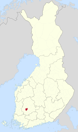
 Location of Nokia in Finland | |
| Coordinates: 61°28′36″N 23°30′19″E / 61.47667°N 23.50528°E | |
| Country | |
| Region | Pirkanmaa |
| Sub-region | Tampere sub-region |
| Metropolitan area | Tampere metropolitan area |
| Charter | 1922 |
| Market town | 1937 |
| City rights | 1977 |
| Government | |
| • Town manager | Markku Rahikkala |
| Area (2018-01-01)[1] | |
• Total | 347.76 km2 (134.27 sq mi) |
| • Land | 288.3 km2 (111.3 sq mi) |
| • Water | 59.58 km2 (23.00 sq mi) |
| • Rank | 237th largest in Finland |
| Population (2024-10-31)[2] | |
• Total | 36,083 |
| • Rank | 33rd largest in Finland |
| • Density | 125.16/km2 (324.2/sq mi) |
| • Demonym | Nokialainen (Finnish) |
| Population by native language | |
| • Finnish | 96.1% (official) |
| • Swedish | 0.3% |
| • Others | 3.6% |
| Population by age | |
| • 0 to 14 | 0% |
| • 15 to 64 | 20,953% |
| • 65 or older | 0% |
| Time zone | UTC+02:00 (EET) |
| • Summer (DST) | UTC+03:00 (EEST) |
| Website | www |
Nokia (Finnish pronunciation: [ˈnokiɑ]) is a town in the Pirkanmaa region of Finland. It lies on the banks of the Nokianvirta, a river of the Kokemäki River watershed, and is situated in the Tampere metropolitan area, about 15 kilometres (9 mi) west of Tampere proper. The population of Nokia is approximately 36,000, while the Tampere metropolitan area has a population of approximately 423,000. It is the 33rd most populous municipality in Finland, and the second largest in the Pirkanmaa region after Tampere.
Nokia's neighbouring municipalities are Hämeenkyrö, Pirkkala, Sastamala, Tampere, Vesilahti and Ylöjärvi. The distance to Tampere Airport from Nokia is 16 kilometres (9.9 mi) by road around Lake Pyhäjärvi.
- ^ "Area of Finnish Municipalities 1.1.2018" (PDF). National Land Survey of Finland. Retrieved 30 January 2018.
- ^ "Finland's preliminary population figure was 5,635,560 at the end of October 2024". Population structure. Statistics Finland. 2024-11-19. ISSN 1797-5395. Retrieved 2024-11-22.
- ^ "Population growth biggest in nearly 70 years". Population structure. Statistics Finland. 2024-04-26. ISSN 1797-5395. Retrieved 2024-04-29.
- ^ a b c d e "Population according to age (1-year) and sex by area and the regional division of each statistical reference year, 2003–2020". StatFin. Statistics Finland. Retrieved 2 May 2021.
- ^ a b "Luettelo kuntien ja seurakuntien tuloveroprosenteista vuonna 2023". Tax Administration of Finland. 14 November 2022. Retrieved 7 May 2023.
