Nome Municipality
Nome kommune | |
|---|---|
 View of Ulefoss | |
 Telemark within Norway | |
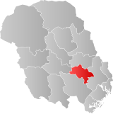
 Nome within Telemark | |
| Coordinates: 59°17′5″N 9°7′26″E / 59.28472°N 9.12389°E | |
| Country | Norway |
| County | Telemark |
| District | Midt-Telemark |
| Established | 1 Jan 1964 |
| • Preceded by | Holla and Lunde |
| Administrative centre | Ulefoss |
| Government | |
| • Mayor (2023) | Linda Therese Thorstensen (Ap) |
| Area | |
| • Total | 429.68 km2 (165.90 sq mi) |
| • Land | 385.42 km2 (148.81 sq mi) |
| • Water | 44.25 km2 (17.09 sq mi) 10.3% |
| • Rank | #230 in Norway |
| Population (2023) | |
| • Total | 6,559 |
| • Rank | #150 in Norway |
| • Density | 17/km2 (40/sq mi) |
| • Change (10 years) | |
| Demonym(s) | Hollasokning or Lundhering[1] |
| Official language | |
| • Norwegian form | Neutral |
| Time zone | UTC+01:00 (CET) |
| • Summer (DST) | UTC+02:00 (CEST) |
| ISO 3166 code | NO-4018[3] |
| Website | Official website |
Nome is a municipality in Telemark county, Norway. It is located in the traditional district of Midt-Telemark and historically part of the Grenland region. The administrative centre of the municipality is the village of Ulefoss. Other villages include Bjervamoen, Ulefoss, Helgja, Flåbygd, and Svenseid.
The 430-square-kilometre (170 sq mi) municipality is the 230th largest by area out of the 356 municipalities in Norway. Nome is the 150th most populous municipality in Norway with a population of 6,559. The municipality's population density is 17 inhabitants per square kilometre (44/sq mi) and its population has decreased by 1% over the previous 10-year period.[4][5]
Nome is a large agricultural and forestry municipality. The agricultural area in Nome is approximately 27,000 decares (10 sq mi). Forest harvesting averaged 36,000 cubic metres (1,300,000 cu ft) annually in the five-year period 2017–2021. Just over half was spruce, the rest was pine.[6]
- ^ "Navn på steder og personer: Innbyggjarnamn" (in Norwegian). Språkrådet.
- ^ "Forskrift om målvedtak i kommunar og fylkeskommunar" (in Norwegian). Lovdata.no.
- ^ Bolstad, Erik; Thorsnæs, Geir, eds. (26 January 2023). "Kommunenummer". Store norske leksikon (in Norwegian). Kunnskapsforlaget.
- ^ Statistisk sentralbyrå. "Table: 06913: Population 1 January and population changes during the calendar year (M)" (in Norwegian).
- ^ Statistisk sentralbyrå. "09280: Area of land and fresh water (km²) (M)" (in Norwegian).
- ^ Nilsen, Jan Erik; Lundbo, Sten, eds. (15 August 2023). "Nome". Store norske leksikon (in Norwegian). Kunnskapsforlaget. Retrieved 3 September 2023.

