This article includes a list of general references, but it lacks sufficient corresponding inline citations. (January 2020) |
 | |
 | |
| Geography | |
|---|---|
| Location | Arctic Ocean |
| Coordinates | 79°48′N 22°24′E / 79.800°N 22.400°E |
| Archipelago | Svalbard |
| Area | 14,443 km2 (5,576 sq mi) 11,009 km2 (4,251 sq mi) glaciated |
| Area rank | 58th |
| Coastline | 1,688 km (1048.9 mi) |
| Highest elevation | 764 m (2507 ft) |
| Highest point | Snøtoppen |
| Administration | |
Norway | |
| Demographics | |
| Population | 0 |
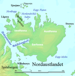
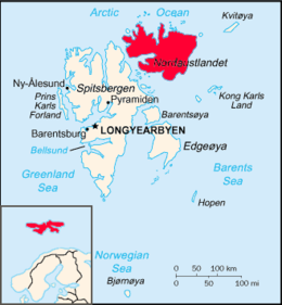
Nordaustlandet (Anglicised as North East Land) is the second-largest island in the archipelago of Svalbard, Norway, with an area of 14,443 square kilometres (5,576 sq mi). It lies north east of Spitsbergen, separated by Hinlopen Strait. Much of Nordaustlandet lies under large ice caps, mainly Austfonna and Vestfonna, the remaining parts of the north being tundra inhabited by reindeer and walruses. The island is uninhabited and lies entirely within Nordaust-Svalbard Nature Reserve.