Norfolk | |
|---|---|
Clockwise from top: Cley next the Sea and its windmill; Norwich Cathedral; and the Guildhall, King's Lynn, showing Norfolk flint flushwork | |
 | |
| Coordinates: 52°40′21″N 00°57′00″E / 52.67250°N 0.95000°E | |
| Sovereign state | United Kingdom |
| Constituent country | England |
| Region | East of England |
| Established | Anglo-Saxon period[1] |
| Time zone | UTC+0 (GMT) |
| • Summer (DST) | UTC+1 (BST) |
| UK Parliament | 9 MPs |
| Police | Norfolk Constabulary |
| Ceremonial county | |
| Lord Lieutenant | The Lady Dannatt MBE |
| High Sheriff | Georgina Roberts (Lady Roberts of Swaffham)[2][3] (2020–21) |
| Area | 5,384 km2 (2,079 sq mi) |
| • Rank | 5th of 48 |
| Population (2022)[4] | 925,299 |
| • Rank | 25th of 48 |
| Density | 172/km2 (450/sq mi) |
| Ethnicity | 96.5% white[5] |
| Non-metropolitan county | |
| County council | Norfolk County Council |
| Control | Conservative |
| Admin HQ | Norwich |
| Area | 5,384 km2 (2,079 sq mi) |
| • Rank | 3rd of 21 |
| Population (2022)[6] | 925,299 |
| • Rank | 7th of 21 |
| Density | 172/km2 (450/sq mi) |
| ISO 3166-2 | GB-NFK |
| GSS code | E10000020 |
| ITL | TLH13 |
| Website | norfolk |
| Districts | |
 Districts of Norfolk | |
| Districts | |
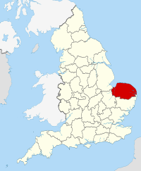
Norfolk (/ˈnɔːrfək/ NOR-fək) is a ceremonial county in the East of England and East Anglia. It borders Lincolnshire and The Wash to the north-west, the North Sea to the north and east, Cambridgeshire to the west, and Suffolk to the south. The largest settlement is the city of Norwich.
The county has an area of 2,074 sq mi (5,370 km2) and a population of 859,400. It is largely rural with few large towns: after Norwich (147,895), the largest settlements are King's Lynn (42,800) in the north-west, Great Yarmouth (38,693) in the east, and Thetford (24,340) in the south. For local government purposes Norfolk is a non-metropolitan county with seven districts.
The west of Norfolk is part of the Fens, an extremely flat former marsh. The centre of the county is gently undulating lowland; its northern coast is an area of outstanding natural beauty, and in the south is part of Thetford Forest. In the east are the Broads, a network of rivers and lakes which extend into Suffolk. The area is protected by the Broads Authority and has similar status to a national park. The geology of the county includes clay and chalk deposits, which make its coast susceptible to erosion.
There is evidence of Prehistoric settlement in Norfolk. In the Roman era the region was home to the Iceni, whose leader Boudica led a major revolt in AD60. The Angles settled the area in the fifth century, and it became part of the Kingdom of East Anglia. During the later Middle Ages the county was very prosperous and heavily involved in the wool trade; this allowed the construction of many large churches. In 1549 Norfolk was the scene of Kett's Rebellion, which unsuccessfully protested the enclosure of land. The county was not heavily industrialised during the Industrial Revolution, and Norwich lost its status as one of England's largest cities. The contemporary economy is largely based on agriculture and tourism.
- ^ Recorded in wills of 1043–45: Ekwall, Eilert (1940) The Concise Oxford Dictionary of English Place-names; 2nd ed. Oxford: Clarendon Press; p. 327 citing Whitelock, Dorothy, ed. Anglo-Saxon Wills. Cambridge, 1930
- ^ "No.62943" (62943). The London Gazette. 13 March 2020: 5161. Archived from the original on 29 October 2020. Retrieved 30 November 2020.
{{cite journal}}: Cite journal requires|journal=(help) - ^ "New High Sheriff of Norfolk announced as Cockley Cley Hall resident". Lynn News. 31 March 2020. Archived from the original on 11 October 2020. Retrieved 30 November 2020.
- ^ "Mid-2022 population estimates by Lieutenancy areas (as at 1997) for England and Wales". Office for National Statistics. 24 June 2024. Retrieved 26 June 2024.
- ^ "Population and demography overview". Norfolk Insight. Archived from the original on 19 February 2015. Retrieved 13 June 2015.
- ^ "Mid-Year Population Estimates, UK, June 2022". Office for National Statistics. 26 March 2024. Retrieved 3 May 2024.


