| Normanby East Normanby, West Normanby, East Normanby North Branch, East Normanby South Branch, Granite Normanby | |
|---|---|
 | |
Location of Normanby River river mouth in Queensland | |
| Etymology | In honour of George Phipps, 2nd Marquess of Normanby[1] |
| Location | |
| Country | Australia |
| State | Queensland |
| Region | Far North Queensland, Cape York Peninsula, Wet Tropics of Queensland |
| Physical characteristics | |
| Source | Great Dividing Range |
| • location | west of Wujal Wujal |
| • coordinates | 15°55′S 145°12′E / 15.917°S 145.200°E |
| Source confluence | East and West Normanby Rivers |
| • coordinates | 15°39′39″S 144°56′17″E / 15.66083°S 144.93806°E |
| • elevation | 125 m (410 ft) |
| Mouth | Princess Charlotte Bay |
• location | Rinyirru National Park |
• coordinates | 14°23′47″S 144°08′37″E / 14.39639°S 144.14361°E |
• elevation | 0 m (0 ft) |
| Length | 350 km (220 mi) |
| Basin size | 24,408 km2 (9,424 sq mi) |
| Discharge | |
| • location | Princess Charlotte Bay |
| • average | 390 m3/s (14,000 cu ft/s) |
| Basin features | |
| Tributaries | |
| • left | Banana Creek (Queensland), Beardmore Creek, Cabbage Tree (Welcome) Creek, Laura River, Kennedy River |
| • right | Nigger Creek (Queensland), Surrender Creek, Trapp Creek, Bridge Creek (Queensland), Jack River (Queensland), House Creek (Queensland) |
| National park | Rinyirru National Park |
| [2][3][4][5][6][7] | |
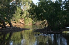
The Normanby River, comprising the East Normanby River, the West Normanby River, the East Normanby River North Branch, the East Normanby River South Branch and the Granite Normanby River, is a river system in Far North Queensland, Australia.
This area is also referred to as the Norman-Laura Catchment and Norman Sub-Basin.[8]
- ^ Cite error: The named reference
qpnwas invoked but never defined (see the help page). - ^ "Map of Normanby River, QLD". Bonzle Digital Atlas of Australia. Retrieved 31 October 2015.
- ^ "Map of East Normanby River, QLD". Bonzle Digital Atlas of Australia. Retrieved 31 October 2015.
- ^ "Map of East Normanby River North Branch, QLD". Bonzle Digital Atlas of Australia. Retrieved 31 October 2015.
- ^ "Map of East Normanby River South Branch, QLD". Bonzle Digital Atlas of Australia. Retrieved 31 October 2015.
- ^ "Map of West Normanby River, QLD". Bonzle Digital Atlas of Australia. Retrieved 31 October 2015.
- ^ "Map of Granite Normanby River, QLD". Bonzle Digital Atlas of Australia. Retrieved 31 October 2015.
- ^ "Story Map Series". qgsp.maps.arcgis.com. Introduction. Retrieved 16 February 2023.
