This article needs additional citations for verification. (March 2023) |
Norristown, Pennsylvania | |
|---|---|
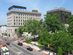
 Main & Swede Streets May 2011 | |
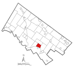
 Location of Norristown in Montgomery County, Pennsylvania | |
Location of Norristown in Pennsylvania | |
| Coordinates: 40°07′12″N 75°20′30″W / 40.12000°N 75.34167°W | |
| Country | United States |
| State | Pennsylvania |
| County | Montgomery |
| Settled | 1682 |
| Borough | 1812 |
| Municipality | 1986 |
| Government | |
| • Type | Council–manager |
| Area | |
| • Total | 3.60 sq mi (9.33 km2) |
| • Land | 3.52 sq mi (9.10 km2) |
| • Water | 0.09 sq mi (0.23 km2) |
| Elevation | 135 ft (41 m) |
| Population | |
| • Total | 35,748 |
| • Density | 10,170.13/sq mi (3,926.44/km2) |
| Demonym | Norristonians |
| Time zone | UTC-5 (EST) |
| • Summer (DST) | UTC-4 (EDT) |
| ZIP Codes | 19401, 19403-19409, 19487-19489 |
| Area codes | 610 and 484 |
| FIPS code | 42-54656 |
| Website | www |
Norristown is a municipality with home rule status and the county seat of Montgomery County, Pennsylvania, United States, in the Philadelphia metropolitan area.[3] Located along the Schuylkill River, approximately 6 miles (9.7 km) from Philadelphia, Norristown had a population of 35,748 as of the 2020 census. It is the fourth-most populous municipality in the county and second-most populous borough in Pennsylvania.[4]
It is the largest non-township municipality in Montgomery County and is located 49.8 miles (80.1 km) southeast of Allentown and 19.9 miles (32.0 km) northwest of Philadelphia.
- ^ "ArcGIS REST Services Directory". United States Census Bureau. Retrieved October 12, 2022.
- ^ Cite error: The named reference
USCensusDecennial2020CenPopScriptOnlywas invoked but never defined (see the help page). - ^ "Find a County". National Association of Counties. Retrieved June 7, 2011.
- ^ Demographic and Information Packet, Montgomery County Planning Commission (MCPC), http://webapp.montcopa.org/planning/dataportal/pdfs/2012demogentiredocument.pdf, page 8.


