North-East | |
|---|---|
 Shashe River centre | |
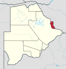
 Location within Botswana | |
| Coordinates: 21°5′S 27°30′E / 21.083°S 27.500°E | |
| Country | |
| Capital | Francistown |
| Area | |
| • Total | 5,120 km2 (1,980 sq mi) |
| Population (2013 census) | |
| • Total | 167,500 |
| • Density | 33/km2 (85/sq mi) |
| Time zone | UTC+2 (Central Africa Time) |
| HDI (2017) | 0.736[1] high · 2nd |
The North-East District is one of the administrative districts of Botswana. Its capital is Francistown. In 2011, North-East had a population of 60,264 people.[2] The district is predominantly occupied by Kalanga-speaking people, the BaKalanga. The district is administered by a district administration and district council, which are responsible for local administration.
In the north and east, the district borders the Matabeleland South Province of Zimbabwe, and the border in the east is predominantly along the Ramokgwebana River. In the south and west, the district borders the Central District along the Shashe River.
- ^ "Sub-national HDI - Area Database - Global Data Lab". hdi.globaldatalab.org. Retrieved 2018-09-13.
- ^ Cite error: The named reference
censuswas invoked but never defined (see the help page).