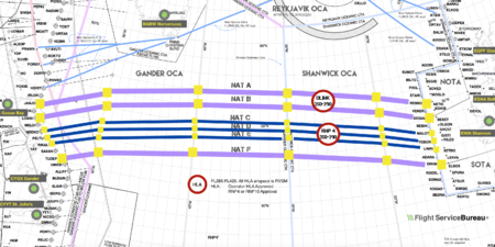
The North Atlantic Tracks, officially titled the North Atlantic Organised Track System (NAT-OTS), are a structured set of transatlantic flight routes that stretch from eastern North America to western Europe across the Atlantic Ocean, within the North Atlantic airspace region. They ensure that aircraft are separated over the ocean, where there is little radar coverage. These heavily travelled routes are used by aircraft flying between North America and Europe, operating between the altitudes of 29,000 and 41,000 ft (8,800 and 12,500 m) inclusive. Entrance and movement along these tracks is controlled by special oceanic control centres to maintain separation between aircraft. The primary purpose of these routes is to allow air traffic control to effectively separate the aircraft. Because of the volume of NAT traffic, allowing aircraft to choose their own co-ordinates would make the air traffic control (ATC) task far more complex. They are aligned in such a way as to minimize any head winds and maximize tail winds impact on the aircraft. This results in much more efficiency by reducing fuel burn and flight time. To make such efficiencies possible, the routes are created twice daily to take account of the shifting of the winds aloft and the principal traffic flow, eastward in North America evening and westward twelve hours later.