North Ayrshire
Scottish Gaelic: Siorrachd Àir a Tuath | |
|---|---|
 | |
 | |
| Coordinates: 55°40′N 4°47′W / 55.667°N 4.783°W | |
| Sovereign state | United Kingdom |
| Country | Scotland |
| Lieutenancy area | Ayrshire and Arran |
| Admin HQ | Cunninghame House, Irvine |
| Government | |
| • Body | North Ayrshire Council |
| • Control | Scottish National Party minority (council NOC) |
| • MPs | |
| • MSPs | |
| Area | |
| • Total | 342 sq mi (885 km2) |
| • Rank | Ranked 17th |
| Population (2022) | |
| • Total | 133,490 |
| • Rank | Ranked 15th |
| • Density | 390/sq mi (150/km2) |
| ONS code | S12000021 |
| ISO 3166 code | GB-NAY |
| Website | www |
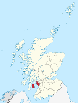
North Ayrshire (Scottish Gaelic: Siorrachd Àir a Tuath, pronounced [ˈʃirˠəxk aːɾʲ ə ˈt̪ʰuə]) is one of 32 council areas in Scotland. The council area borders Inverclyde to the north, Renfrewshire and East Renfrewshire to the northeast, and East Ayrshire and South Ayrshire to the east and south respectively. The local authority is North Ayrshire Council, formed in 1996 with the same boundaries as the district of Cunninghame which existed from 1975 to 1996.
Located in the west central Lowlands with the Firth of Clyde to its west, the council area covers the northern portion of the historic county of Ayrshire, in addition to the islands of Arran and The Cumbraes from the historic county of Buteshire.[1] North Ayrshire has a population of roughly 133,490 people.[2] Its largest towns are Irvine and Kilwinning.
- ^ "East coast, Firth of Clyde" (PDF). Retrieved 16 December 2016.
- ^ "Mid-Year Population Estimates, UK, June 2022". Office for National Statistics. 26 March 2024. Retrieved 3 May 2024.

