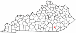
North Corbin, Kentucky | |
|---|---|
 Location of North Corbin, Kentucky | |
| Coordinates: 36°57′53″N 84°05′50″W / 36.96472°N 84.09722°W | |
| Country | United States |
| State | Kentucky |
| Counties | Laurel, Knox |
| Area | |
• Total | 1.80 sq mi (4.66 km2) |
| • Land | 1.78 sq mi (4.61 km2) |
| • Water | 0.02 sq mi (0.05 km2) |
| Elevation | 1,204 ft (367 m) |
| Population (2020) | |
• Total | 1,727 |
| • Density | 970.22/sq mi (374.59/km2) |
| Time zone | UTC-5 (Eastern (EST)) |
| • Summer (DST) | UTC-4 (EDT) |
| ZIP Code | 40701 (Corbin) |
| Area code | 606 |
| FIPS code | 21-56694 |
| GNIS feature ID | 2403345[2] |
North Corbin is a census-designated place (CDP) in Laurel and Knox counties in the U.S. state of Kentucky. The population was 1,727 at the 2020 census[3] down from 1,773 at the 2010 census.[4] The census bureau also lists the Laurel County portion of North Corbin as a CCD with a population of 10,729.[5]
The city of Corbin is located south of North Corbin.
The Harland Sanders Café and Museum, the restaurant where Colonel Sanders developed the fried chicken recipe that would later become famous as Kentucky Fried Chicken, is located in the Laurel County portion of North Corbin.
- ^ "2020 U.S. Gazetteer Files". United States Census Bureau. Retrieved March 18, 2022.
- ^ a b U.S. Geological Survey Geographic Names Information System: North Corbin, Kentucky
- ^ "North Corbin CDP, Kentucky Demographics and Housing 2020 Decennial Census".
- ^ "Geographic Identifiers: 2010 Demographic Profile Data (G001): North Corbin CDP, Kentucky". American Factfinder. U.S. Census Bureau. Retrieved March 7, 2019.[dead link]
- ^ "North Corbin CCD, Laurel County, Kentucky Demographics and Housing 2020 Decennial Census".