| North Mountain | |
|---|---|
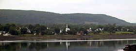
 North Mountain ridge above Granville Ferry, Nova Scotia | |
| Highest point | |
| Peak | Mount Rose |
| Elevation | 235 m (771 ft) |
| Coordinates | 45°6′0″N 64°45′0″W / 45.10000°N 64.75000°W |
| Geography | |
| Country | Canada |
| Provinces | Nova Scotia |
| Topo map(s) | NTS 21A Annapolis Royal 21B Eastport 21H Amherst |
| Geology | |
| Rock age | Triassic |
| Rock type | Igneous |

30miles
North Mountain (French: Montagne du Nord; Gaelic: Beinn a Tuath) is a narrow southwest-northeast trending volcanic ridge on the mainland portion of southwestern Nova Scotia, stretching from Brier Island to Cape Split. It forms the northern edge of the Annapolis Valley along the shore of the Bay of Fundy. Together with South Mountain, the two ranges form the Annapolis Highlands region. [citation needed]
North Mountain rises dramatically from the valley floor and tapers somewhat more gradually to the north and west where it meets the coast, although many parts of this coast have vertical cliffs rising higher than 30 metres, most notably at Cape Split. A break occurs at Digby Gut where a gap in the mountain ridge is filled by a deep tidal channel separating the eastern end of the mountain from Digby Neck.
The highest point on the ridge is at Mount Rose in Annapolis County, north of Lawrencetown.

