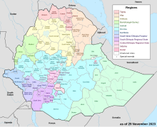

North Omo Zone (Amharic: ሰሜን ኦሞ) was a zone in the Southern Nations, Nationalities, and Peoples' Region of Ethiopia. It was named after the Omo River, which flows in the western area of the former zone. In 2000 it was split into three zones: Dawro, Gamo Gofa, and Wolayita; and Basketo and Konta became special woredas.[1][2]
Semien Omo was bordered on the south by Debub Omo, on the west by Keficho Shekicho, on the northwest by the Oromia Region, on the north by Kembata Tembaro, on the northeast by part of the Oromia Region, on the east by the Bilate River which separated it from Sidama and another part of the Oromia Region, and on the southeast by the Amaro and Dirashe special woredas. The highest point in Semien Omo was Mount Guge (3568 m), west of Chencha. The administrative center of Semien Omo was Arba Minch; other towns included Areka, Boditi, Sawla and Sodo.
- ^ Names and codes for January 2000, Ethiopia (WHO website). The information in the WHO spreadsheet is built on information received 18 September 2002 from the Ethiopian Ministry of Federal Affairs.
- ^ Cite error: The named reference
Vaughanwas invoked but never defined (see the help page).