| North Umpqua River | |
|---|---|
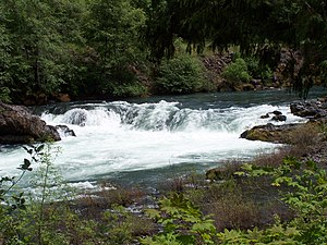
 Deadline Falls on the North Umpqua River | |
 Map of the Umpqua River watershed | |
| Location | |
| Country | United States |
| State | Oregon |
| County | Douglas |
| Physical characteristics | |
| Source | Maidu Lake |
| • location | Cascade Range |
| • coordinates | 43°15′17″N 122°00′02″W / 43.25472°N 122.00056°W[2] |
| • elevation | 5,998 ft (1,828 m)[3] |
| Mouth | Confluence of the North Umpqua and South Umpqua rivers |
• location | near Roseburg |
• coordinates | 43°16′05″N 123°26′45″W / 43.26806°N 123.44583°W[1] |
• elevation | 361 ft (110 m)[1] |
| Length | 106 mi (171 km)[4] |
| Basin size | 1,356 sq mi (3,510 km2)[4] |
| Discharge | |
| • location | Winchester[5] |
| • average | 3,687 cu ft/s (104.4 m3/s)[5] |
| • minimum | 235 cu ft/s (6.7 m3/s) |
| • maximum | 150,000 cu ft/s (4,200 m3/s) |
| Type | Recreational |
| Designated | October 28, 1988 |
The North Umpqua River is a tributary of the Umpqua River, about 106 miles (171 km) long, in southwestern Oregon in the United States. It drains a scenic and rugged area of the Cascade Range southeast of Eugene, flowing through steep canyons and surrounded by large Douglas-fir forests. Renowned for its emerald green waters, it is considered one of the best fly fishing streams in the Pacific Northwest for anadromous fish.
- ^ a b "North Umpqua River". Geographic Names Information System. United States Geological Survey. November 28, 1980. Retrieved December 30, 2011.
- ^ "United States Topographic Map". United States Geological Survey. Retrieved December 29, 2015 – via Acme Mapper.
- ^ Source elevation derived from Google Earth search using topographic map coordinates for Maidu Lake.
- ^ a b Palmer, Tim (2014). Field Guide to Oregon Rivers. Corvallis: Oregon State University Press. pp. 129–33. ISBN 978-0-87071-627-0.
- ^ a b "Water-data report 2010: 14319500 North Umpqua River at Winchester, OR" (PDF). United States Geological Survey. Retrieved December 30, 2011.
