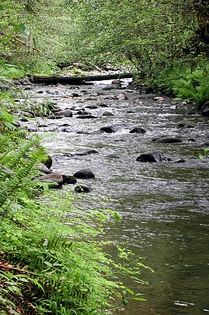
| North Yamhill River | |
|---|---|
 North Yamhill River near Flying M Airport | |
| Etymology | Uncertain but probably after a local Kalapuya tribe[2] |
| Location | |
| Country | United States |
| State | Oregon |
| County | Yamhill |
| Physical characteristics | |
| Source | Northern Oregon Coast Range |
| • location | Siuslaw National Forest, in western Yamhill County, Oregon |
| • coordinates | 45°23′51″N 123°25′23″W / 45.39750°N 123.42306°W[1] |
| • elevation | 2,467 ft (752 m)[3] |
| Mouth | Yamhill River |
• location | between McMinnville and Dayton, Yamhill County, Oregon |
• coordinates | 45°13′33″N 123°08′42″W / 45.22583°N 123.14500°W[1] |
• elevation | 75 ft (23 m)[1] |
| Length | 31 mi (50 km)[4] |
| Basin size | 177 sq mi (460 km2)[5] |
The North Yamhill River is a 31-mile (50 km) tributary of the Yamhill River in the U.S. state of Oregon. It drains an area of the Northern Oregon Coast Range, as well as part of the Willamette Valley west of the Willamette River.[4][6]
Rising in a remote area in the mountains of northwestern Yamhill County, the river flows generally east, then southeast, then south past the city of Yamhill. It joins the South Yamhill River about 2 miles (3.2 km) east of McMinnville to form the Yamhill River.[4][6]
- ^ a b c "North Yamhill River". Geographic Names Information System. United States Geological Survey. November 28, 1980. Retrieved January 25, 2009.
- ^ McArthur, Lewis A.; McArthur, Lewis L. (2003). Oregon Geographic Names, Seventh Edition. Portland, Oregon: Oregon Historical Society Press. p. 1063. ISBN 0-87595-277-1.
- ^ Source elevation derived from Google Earth search using GNIS source coordinates.
- ^ a b c United States Geological Survey. "United States Geological Survey Topographic Map: Gobblers Knob, Trask Mountain, Fairdale, Carlton, and McMinnville, Oregon, quads". TopoQuest. Retrieved January 24, 2009. The maps include river mile (RM) markers from the mouth to RM 29 (river kilometer 47), upstream of the Flying M Airport.
- ^ "Map 1: The Yamhill River Basin & the Chehalem Valley" (PDF). Yamhill Basin Council. 2002. Archived from the original (pdf) on December 26, 2004. Retrieved January 22, 2009.
- ^ a b Oregon Atlas & Gazetteer (Map) (1991 ed.). DeLorme Mapping. § 58–59. ISBN 0-89933-235-8.
