This article needs additional citations for verification. (May 2017) |
Northern Region
ภาคเหนือ | |
|---|---|
|
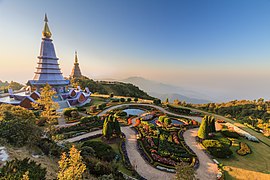
From upper-left to lower-right: Doi Inthanon, Doi Pha Hom Pok, Wat Phra That Doi Suthep, Fourth Thai–Lao Friendship Bridge and Phu Chi Fa | |
 Northern Region in Thailand | |
| Largest city | Chiang Mai |
| Provinces | |
| Area | |
• Total | 96,077 km2 (37,096 sq mi) |
| Population (2019)[2] | |
• Total | 6,350,499 |
| • Density | 66/km2 (170/sq mi) |
| Demonym | Khon Muang |
| GDP | |
| • Total | US$41.9 billion (2019) |
| Time zone | UTC+07:00 (ICT) |
| Language | Thai • Northern Thai • Lolo-Burmese • Karenic • • Mienic • Palaungic • Southwestern Mandarin etc. |
Northern Thailand, or more specifically Lanna, is geographically characterised by several mountain ranges, which continue from the Shan Hills in bordering Myanmar to Laos, and the river valleys that cut through them. Like most of Thailand, it has a tropical savanna climate, but its relatively high elevation and latitude contribute to more pronounced seasonal temperature variation, with cooler winters than the other regions.
Historically, northern Thailand has been linked to the Hariphunchai Kingdom, which emerged as a powerful state in the region in the 7th century. This kingdom was related to the Dvaravati that existed from the 6th to 11th centuries. The Hariphunchai culture later influenced the development of the Lanna Kingdom, which emerged in the 13th century and lasted until the 18th century.[4][5]
- ^ "ตารางที่ 2 พี้นที่ป่าไม้ แยกรายจังหวัด พ.ศ.2562" [Table 2 Forest area Separate province year 2019]. Royal Forest Department (in Thai). 2019. Retrieved 6 April 2021, information, Forest statistics Year 2019, Thailand boundary from Department of Provincial Administration in 2013
{{cite web}}: CS1 maint: postscript (link) - ^ รายงานสถิติจำนวนประชากรและบ้านประจำปี พ.ส.2562 [Statistics, population and house statistics for the year 2019]. Registration Office Department of the Interior, Ministry of the Interior. stat.bora.dopa.go.th (in Thai). 31 December 2019. Retrieved 26 February 2020.
- ^ "Gross Regional and Provincial Product, 2019 Edition". <>. Office of the National Economic and Social Development Council (NESDC). July 2019. ISSN 1686-0799. Retrieved 22 January 2020.
- ^ Tan, Heidi (2012), "The Many Streams of Buddhist Art in Thailand", Enlightened Ways: The Many Streams of Buddhist Art in Thailand, Asian Art Museum of San Francisco, p. 13
- ^ Smith, John (2019). State, Community, and Ethnicity in Early Modern Thailand, 1351-1767 (PDF) (Ph.D. dissertation). University of Michigan. p. 40. Retrieved 2023-04-08.


