| Ecoregion: Northern Vietnam lowland rain forests | |
|---|---|
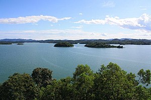
 Lake Song Muc in Ben En National Park | |
 Ecoregion territory (in purple) | |
| Ecology | |
| Realm | Indomalayan |
| Biome | Tropical and subtropical moist broadleaf forests |
| Geography | |
| Area | 22,532 km2 (8,700 sq mi) |
| Country | |
| Coordinates | 19°N 105°E / 19°N 105°E |
The Northern Vietnam lowland rain forests ecoregion (WWF ID: IM0141) covers the central-eastern coast of Vietnam from the Red River delta in the north to Tam Kỳ in the center of the country and neighboring adjacent parts of Laos. The region is one of the wet evergreen forests, with rain over 50 mm in every month. The forests have been highly degraded by human use, and the high levels of biodiversity have been pushed back into relatively small protected areas like Pu Mat National Park.[1][2][3]
- ^ "Northern Vietnam lowland rain forests". World Wildlife Federation. Archived from the original on September 24, 2020. Retrieved March 21, 2020.
- ^ "Map of Ecoregions 2017". Resolve, using WWF data. Archived from the original on April 12, 2017. Retrieved September 14, 2019.
- ^ "Northern Vietnam lowland rain forests". Digital Observatory for Protected Areas. Archived from the original on May 11, 2022. Retrieved August 1, 2020.