Northfield, Massachusetts | |
|---|---|
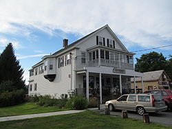
 Mim's Market | |
 Location in Franklin County in Massachusetts | |
| Coordinates: 42°41′45″N 72°27′12″W / 42.69583°N 72.45333°W | |
| Country | United States |
| State | Massachusetts |
| County | Franklin |
| Settled | 1673 |
| Incorporated | 1723 |
| Government | |
| • Type | Open town meeting |
| Area | |
• Total | 35.4 sq mi (91.6 km2) |
| • Land | 34.3 sq mi (88.8 km2) |
| • Water | 1.1 sq mi (2.8 km2) |
| Elevation | 381 ft (116 m) |
| Population (2020) | |
• Total | 2,866 |
| • Density | 81/sq mi (31/km2) |
| Time zone | UTC-5 (Eastern) |
| • Summer (DST) | UTC-4 (Eastern) |
| ZIP code | 01360 |
| Area code | 413 |
| FIPS code | 25-47835 |
| GNIS feature ID | 0619381[1] |
| Website | www |
Northfield is a town in Franklin County, Massachusetts, United States. Northfield was first settled in 1673. The population was 2,866 at the 2020 census.[2] It is part of the Springfield, Massachusetts Metropolitan Statistical Area. The Connecticut River runs through the town, dividing West Northfield from East Northfield and the village of Northfield, where the town hall is located.
Part of the town is included in the census-designated place of Northfield.
