| Nourlangie Rock Northern Territory | |
|---|---|
 Nourlangie Rock | |
| Coordinates | 12°51′42″S 132°48′45″E / 12.86167°S 132.81250°E |
| Website | Nourlangie Rock |
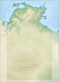
Burrunggui (sometimes spelled Burrunguy, previously called Nourlangie Rock) is located in an outlying sandstone[1] formation of the Arnhem Land Escarpment within the Kakadu National Park in the Northern Territory of Australia. It is the traditional Country of the Gun-djeihmi speaking people and according to traditional owners, was shaped by Ancestral beings in the creation period of the Dreaming[1] (Chaloupka 1982 p. 6). It was included on the World Heritage Register.[2] Kakadu National Park is included on UNESCO the World Heritage List due to its exceptional natural and cultural values.[3]
Europeans were first in the area of Noulangie Rock in about 1845, after Ludwig Leichhardt’s explorations passed through the area.[1] By the 1880s, European buffalo and buffalo shooters had moved into the area and local traditional owners joined their shooting parties.[1] Traditional owners told the buffalo shooters about the Dreaming stories at Burrungui and the many names of all the natural features of the landscapes. Chaloupka argues that the Europeans couldn’t remember all of the names, and called ‘Nourlangie’, a confused pronunciation of the name of the area generally called ‘Nawulandja’.[1]
- ^ a b c d e Chaloupka, George (1982). Burrunguy: Nourlangie Rock. Nothhart. ISBN 094969200X.
- ^ "Department of the Environment".
- ^ Centre, UNESCO World Heritage. "UNESCO World Heritage Centre - World Heritage List". whc.unesco.org. Retrieved 13 June 2016.
