 | |
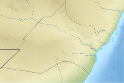
 Nugaal relief location map | |
| Coordinates: 8°45′34″N 48°53′21″E / 8.75944°N 48.88917°E | |
| Regional State | |
| Capital | Garowe |
| Government | |
| • Governor | Omar Abdullahi Mohamed |
| Area | |
• Total | 26,180 km2 (10,110 sq mi) |
| Elevation | 1,650 m (5,410 ft) |
| Population (2019[1]) | |
• Total | 473,900 |
| • Density | 18/km2 (47/sq mi) |
| Time zone | UTC+3 (EAT) |
| Area code | +252 |
| HDI (2021) | 0.378[2] low · 6th of 18 |
Nugal (Somali: Nugaal, Arabic: نوغال, Italian: Nogal), traditionally known as Nugaaleed-Bari or Bari-Nugaal meaning eastern Nugaal, or Nugaal xaggeeda hoose meaning lower Nugaal, is an administrative region (gobol) in northern Somalia.[3]
- ^ "Somalia: Subdivision and cities". www.citypopulation.de. Archived from the original on 2024-04-25. Retrieved 2024-02-14.
- ^ "Sub-national HDI - Area Database - Global Data Lab". hdi.globaldatalab.org. Archived from the original on 2018-09-23. Retrieved 2018-09-13.
- ^ "Somalia". The World Factbook. Langley, Virginia: Central Intelligence Agency. Archived from the original on 1 July 2014. Retrieved 6 December 2013.

