32°2′28″N 42°15′17″E / 32.04111°N 42.25472°E
An Nukhayb
النخيب | |
|---|---|
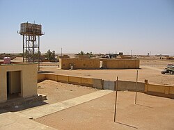
 View of town from the roof of the school | |
| Coordinates: 32°2′28″N 42°15′17″E / 32.04111°N 42.25472°E | |
| Country | |
| Governorate | Anbar Governorate |
| District | Ar-Rutba District |
| Area | |
| • Land | 48,790 km2 (18,840 sq mi) |
| Population (2018) | |
| • Total | 3,571 |
| Time zone | UTC+3 (GMT+3) |
| Postal code | 31016 |
An Nukhayb (Arabic: النخيب, alt. Nukhaib, Nkheeb) is a town in Al Anbar Governorate, Iraq. Prior to the 1940s and during a short period in the 1970s, the town was administered by the Karbala Governorate. There has been conflict regarding to which governorate the town should belong.[1][2]
Nukhayb is located on the Al-Abyad Wadi at the largest road junction in the region, with roads going south to the Saudi Arabian border, north to the Ramadi–Jordan highway, and northeast to Karbala. Nukhayb is the last Iraqi town before pilgrims cross into Saudi Arabia on their pilgrimage to Mecca. It has two satellite villages to the north, Habbariya (28 km) and Kesrah (51 km).[3] Mudaysis Air Base is located 50 km to the northwest of Nukhayb.
- ^ Turki, Ibrahim. "Battle For The Iraqi Outback Town On A Cultural Crossroads". Niqash.
- ^ "Fears of fresh outbreak of sectarian violence grip Iraq". The National.ae.
- ^ Bajallat Markaz Buḥūth Al-Tārīkh Al-Ṭabīʻī. The Center. 1975. Retrieved 15 September 2013.
