Nuristan
نورستان | |
|---|---|
Nuristan Province | |
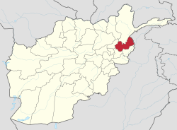
 Map of Afghanistan with Nuristan highlighted | |
| Coordinates: 35°15′N 70°45′E / 35.25°N 70.75°E | |
| Country | |
| Provincial center | Parun |
| Government | |
| • Governor | Hafiz Muhammad Aagha |
| • Deputy Governor | Sheikh Ismatullah[1] |
| Area | |
| • Total | 9,225.0 km2 (3,561.8 sq mi) |
| Population (2021)[2] | |
| • Total | 166,676 |
| • Density | 18/km2 (47/sq mi) |
| Time zone | UTC+4:30 (Afghanistan Time) |
| Postal Code | 29XX |
| ISO 3166 code | AF-NUR |
| Main languages | Nuristani languages Pashto |
Nuristan, also spelled as Nurestan or Nooristan (Pashto: نورستان; Kamkata-vari:[a] Nuriston), is one of the 34 provinces of Afghanistan, located in the eastern part of the country. It is divided into seven districts and is Afghanistan's least populous province, with a population of around 167,000.[2] Parun serves as the provincial capital. Nuristan is bordered on the south by Laghman and Kunar provinces, on the north by Badakhshan province, on the west by Panjshir province, and on the east by Pakistan.
The origin of the local Nuristani people has been disputed, ranging from being the indigenous inhabitants forced to flee to this region after refusing to surrender to invaders, to being linked to various ancient groups of people and the Turk Shahi kings.[3][4] Some Nuristanis claim being descendants of the Greek occupying forces of Alexander the Great. It was formerly called Kafiristan (Pashto: كافرستان) ("Land of the Infidels") until the inhabitants were forcibly converted from an animist religion[5][6] with elements from Indo-Iranian (Vedic- or Hindu-like) religion infused with local variations,[7][8][b] to Islam in 1895, and thence the region has become known as Nuristan ("land of illumination", or "land of light").[9] The region was located in an area surrounded by Buddhist civilizations which were later taken over by Muslims.[10]
The primary occupations are agriculture, animal husbandry, and day labor. Located on the southern slopes of the Hindu Kush mountains in the northeastern part of the country, Nuristan spans the basins of the Alingar, Pech, Landai Sin, and Kunar rivers. Most of Nuristan is covered by mountainous forests and it has a rich biodiversity with a domestically unique monsoon climate by air coming from the Indian Ocean.[11] As of 2020, the entirety of Nuristan is now a protected national park.[12][13]
- ^ "د نورستان مرستیال والي وانټ وایګل ته سفر وکړ" [Vice-Governor of Nuristan visited Vant Weigel]. bakhtarnews.af.
- ^ a b "Estimated Population of Afghanistan 2021–22" (PDF). National Statistic and Information Authority (NSIA). April 2021. Archived (PDF) from the original on 24 June 2021. Retrieved 21 June 2021.
- ^ Cite error: The named reference
Ludwigwas invoked but never defined (see the help page). - ^ Cite error: The named reference
Genesiswas invoked but never defined (see the help page). - ^ Ansary 2014.
- ^ Cite error: The named reference
nuristan.infowas invoked but never defined (see the help page). - ^ Minahan 2014, p. 205.
- ^ Barrington, Kendrick & Schlagintweit 2006, p. 111.
- ^ Klimberg 2004.
- ^ Cite error: The named reference
academiawas invoked but never defined (see the help page). - ^ "Afghanistan Bright Spot: Wildlife Thriving in War Zones". National Geographic Society. 14 July 2011. Archived from the original on 15 September 2019.
- ^ Reza Shirmohammad. "ولایت نورستان در افغانستان به عنوان پارک ملی اعلام گردید" [Nuristan province in Afghanistan was declared as a national park]. Deutsche Welle.
- ^ "Residents Welcome Designation of National Park in Nuristan".
Cite error: There are <ref group=lower-alpha> tags or {{efn}} templates on this page, but the references will not show without a {{reflist|group=lower-alpha}} template or {{notelist}} template (see the help page).


