| Nyerere National Park | |
|---|---|
| Selous Game Reserve | |
 | |
| Location | Location in Tanzania |
| Nearest city | Morogoro City |
| Coordinates | 9°0′S 37°24′E / 9.000°S 37.400°E |
| Area | 30,893 km2 |
| Established | 2019 |
| Governing body | Tanzania National Parks Authority |
| tanzaniaparks | |
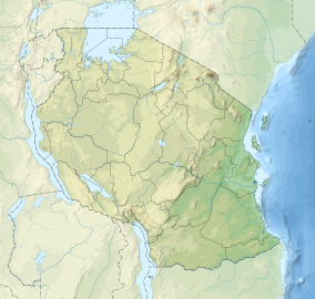
Nyerere National Park (formerly the northern part of Selous Game Reserve, pronunciation: "Seluu") is the largest national park in Tanzania and also one of the world's largest wildlife sanctuaries and national parks. The total area of the park is 30,893 km2 (11,928 sq mi) and covers the big part of Liwale District in western Lindi Region, south west Pwani Region, north eastern Ruvuma Region and a big part of south eastern Morogoro Region.[1] The park is about the size of Belgium (Europe). Much of the area is in a wild state without being altered by human activities. The part of Selous game reserve is now running a hydro electric power. The park has a great river known as Rufiji River. Rufiji is Tanzania's largest river and is home to many crocodiles and hippopotamuses. It is also one of largest mangrove forests in the world located at its delta.
- ^ "The Newly-Established Nyerere National Park". EABWNews. 5 February 2020. Retrieved 7 January 2021.
