Nyssa, Oregon | |
|---|---|
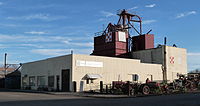
 Oregon Trail Agriculture Museum in Nyssa | |
| Nickname: Thunderegg Capital of the World | |
| Motto: Gateway to the Oregon Trail | |
 Location in Oregon | |
| Coordinates: 43°52′45″N 116°59′49″W / 43.87917°N 116.99694°W | |
| Country | United States |
| State | Oregon |
| County | Malheur |
| Incorporated | 1903 |
| Government | |
| • Mayor | Betty Holcomb |
| Area | |
• Total | 1.55 sq mi (4.01 km2) |
| • Land | 1.55 sq mi (4.01 km2) |
| • Water | 0.00 sq mi (0.00 km2) |
| Elevation | 2,192 ft (668 m) |
| Population | |
• Total | 3,198 |
| • Density | 2,063.23/sq mi (796.84/km2) |
| Time zone | UTC-7 (Mountain) |
| • Summer (DST) | UTC-6 (Mountain) |
| ZIP code | 97913 |
| Area code | 541 |
| FIPS code | 41-53750[3] |
| GNIS feature ID | 1124870[4] |
| Website | www.nyssacity.org |
Nyssa (/ˈnɪsə/ NISS-ə) is a city in Malheur County, Oregon, United States. The population was 3,267 at the 2010 census. The city is located along the Snake River on the Idaho border, in the region of far eastern Oregon known as the "Treasure Valley". It is part of the Ontario, OR–ID Micropolitan Statistical Area.
The primary industry in the region is agriculture, including the cultivation of Russet potatoes, sugar beets, onions, corn, flower seed, mint, and wheat. The city's economy relies on the surrounding agricultural area with its several large onion and potato packaging plants.
- ^ "ArcGIS REST Services Directory". United States Census Bureau. Retrieved October 12, 2022.
- ^ Cite error: The named reference
USCensusDecennial2020CenPopScriptOnlywas invoked but never defined (see the help page). - ^ Cite error: The named reference
wwwcensusgovwas invoked but never defined (see the help page). - ^ "US Board on Geographic Names". United States Geological Survey. October 25, 2007. Retrieved January 31, 2008.