| Oahe Dam | |
|---|---|
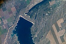
 Oahe Dam from the International Space Station | |
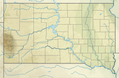
| Location | Hughes/Stanley counties, South Dakota |
| Coordinates | 44°27′07″N 100°23′57″W / 44.45194°N 100.39917°W |
| Construction began | 1948 |
| Opening date | 1962 |
| Construction cost | $340 Million |
| Operator(s) | |
| Dam and spillways | |
| Type of dam | Embankment, Rolled-earth fill & shale berms |
| Impounds | Missouri River |
| Height | 245 feet (75 m) |
| Length | 9,360 feet (2,850 m) |
| Width (base) | 3,500 feet (1,100 m) |
| Dam volume | 93,122,000 cubic yards (71,197,000 m3) |
| Spillways | 8 50-foot x 23.5-foot tainter gates |
| Spillway capacity | 304,000 cfs at 1,644.4 feet msl pool elevation |
| Reservoir | |
| Creates | Lake Oahe |
| Total capacity | 23,137,000 acre-feet (28.539 km3)[1] |
| Surface area | 374,000 acres (151,000 ha)[1] (max) |
| Power Station | |
| Commission date | April 1962–June 1963[1] |
| Turbines | 7x 112.29 MW |
| Installed capacity | 786 MW |
| Annual generation | 2,621 GWh[1] |
| Website U.S. Army Corps of Engineers - Oahe Project | |
The Oahe Dam (/oʊˈɑːhiː/) is a large earthen dam on the Missouri River, just north of Pierre, South Dakota, United States. Begun in 1948 and opened in 1962, the dam creates Lake Oahe, the fourth-largest man-made reservoir in the United States. The reservoir stretches 231 miles (372 km) up the course of the Missouri to Bismarck, North Dakota. The dam's power plant provides electricity for much of the north-central United States. It is named for the Oahe Indian Mission established among the Lakota Sioux in 1874.
The project provides flood control, hydropower generation, irrigation, and navigation benefits. Oahe Dam is one of six Missouri River mainstem dams, the next dam upstream is Garrison Dam, near Riverdale, North Dakota, and the next dam downstream is Big Bend Dam, near Fort Thompson, South Dakota.
South Dakota Highway 204 runs directly atop the Oahe Dam, providing an automobile crossing of the Missouri River at the dam.
- ^ a b c d "Summary of Engineering Data – Missouri River Main Stem System" (PDF). Missouri River Division. U.S. Army Corps of Engineers. August 2010. Archived from the original (PDF) on February 7, 2012. Retrieved August 17, 2012.
