Oakdale | |
|---|---|
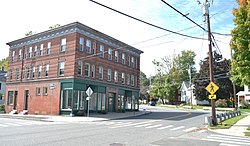
 The Oakdale Pharmacy building, a former streetcar stop and one of the neighborhood's few commercial blocks | |
| Coordinates: 42°12′15.3″N 72°37′28.31″W / 42.204250°N 72.6245306°W | |
| Country | United States |
| State | Massachusetts |
| City | Holyoke |
| Wards | 4, 6 |
| Precincts | 4A, 4B, 6A, 6B |
| Established | August 1885 |
| Founded by | Oren D. Allyn |
| Area | |
| • Total | 0.72 sq mi (1.9 km2) |
| Elevation | 190 ft (58 m) |
| ZIP code | 01040 |
| Area code | 413 |
| GNIS feature ID | 609059[2] |
| MACRIS ID | HLY.E |
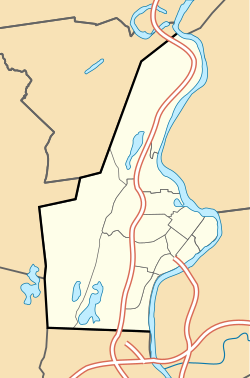
Oakdale is a neighborhood in Holyoke, Massachusetts located to the west of the city center, adjacent to downtown. Developed as a streetcar suburb in the late nineteenth century, today the neighborhood contains many Victorian houses, and about 460 acres (190 ha) of mixed residential and commercial zoning, as well as Forestdale Cemetery, Saint Jerome Cemetery, Rohan Park, and Holyoke Medical Center.[1][3]
- ^ a b Spatial analysis of "Holyoke Neighborhoods" (PDF). Archived from the original (PDF) on August 2, 2017. Retrieved June 3, 2016.
- ^ a b "Rock Valley, Holyoke, Massachusetts". Geographic Names Information System. United States Geological Survey, United States Department of the Interior. Retrieved February 13, 2018.
- ^ HLY.E, MACRIS, Massachusetts Historical Commission.


