Ocean Bluff-Brant Rock, Massachusetts | |
|---|---|
 Ocean Bluff looking south | |
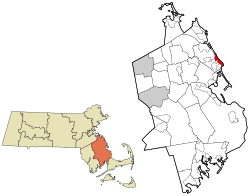
 Location in Plymouth County in Massachusetts | |
| Coordinates: 42°6′6″N 70°39′39″W / 42.10167°N 70.66083°W | |
| Country | United States |
| State | Massachusetts |
| County | Plymouth |
| Area | |
• Total | 4.39 sq mi (11.37 km2) |
| • Land | 2.17 sq mi (5.63 km2) |
| • Water | 2.21 sq mi (5.74 km2) |
| Population (2020) | |
• Total | 4,744 |
| • Density | 2,181.15/sq mi (842.28/km2) |
| Time zone | UTC-5 (Eastern (EST)) |
| • Summer (DST) | UTC-4 (EDT) |
| Area code | 781/339 |
| FIPS code | 25-50862 |


Ocean Bluff-Brant Rock is a census-designated place (CDP) in Plymouth County, Massachusetts, United States, composed of the neighborhoods of Ocean Bluff, Brant Rock, Fieldston, and Rexhame in the town of Marshfield. The population of the CDP was 4,970 at the 2010 census.[2]
- ^ "2020 U.S. Gazetteer Files". United States Census Bureau. Retrieved May 21, 2022.
- ^ "Profile of General Population and Housing Characteristics: 2010 Demographic Profile Data (DP-1): Ocean Bluff-Brant Rock CDP, Massachusetts". United States Census Bureau. Retrieved March 26, 2012.