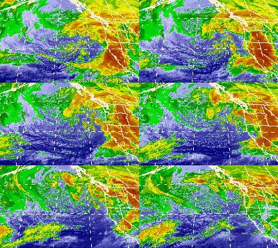
 Infrared satellite loop of the system off the coast of the Western United States, from October 13–14 | |
| Type | Aleutian Low Extratropical cyclone Coastal storm Blizzard Winter storm |
|---|---|
| Formed | October 7, 2009[1] |
| Dissipated | October 20, 2009[2] |
| Highest gust | 135 mph (217 km/h) along the Sierra Crest |
| Lowest pressure | 966 mbar (28.5 inHg)[3] |
| Maximum snowfall or ice accretion | 23 in (580 mm) at Mammoth Mountain Ski Area |
| Maximum rainfall | 21.34 in (542 mm) of rain in Monterey County, California |
| Fatalities | 2 |
| Damage | $8.861 million (2009 USD)[4][5][6] |
| Areas affected | Southeast Alaska, Western Canada, Eastern Canada, Contiguous United States, Northern Mexico |
Part of the 2009–10 North American winter storms | |
The October 2009 North American storm complex was a powerful extratropical cyclone that was associated with the remnants of Typhoon Melor, which brought extreme amounts of rainfall to California. The system started out as a weak area of low pressure (an Aleutian Low), that formed in the northern Gulf of Alaska on October 7. Late on October 11, the system quickly absorbed Melor's remnant moisture, which resulted in the system strengthening significantly offshore, before moving southeastward to impact the West Coast of the United States, beginning very early on October 13.[7] Around the same time, an atmospheric river opened up (the Pineapple Express), channeling large amounts of moisture into the storm, resulting in heavy rainfall across California and other parts of the Western United States. The storm caused at least $8.861 million (2009 USD) in damages across the West Coast of the United States.[4][6][5]
- ^ "WPC Surface Analysis Archive".
- ^ "WPC Surface Analysis Archive".
- ^ "WPC Surface Analysis Archive".
- ^ a b Storm Events Database: California: 73 events were reported between 10/12/2009 and 10/15/2009 (4 days). ncdc.noaa.gov (Report). NCEI. October 2009. Retrieved October 27, 2021.
- ^ a b Storm Events Database: Washington: 1 events were reported between 10/12/2009 and 10/15/2009 (4 days). ncdc.noaa.gov (Report). NCEI. October 2009. Retrieved October 27, 2021.
- ^ a b Storm Events Database: Oregon: 4 events were reported between 10/12/2009 and 10/15/2009 (4 days). ncdc.noaa.gov (Report). NCEI. October 2009. Retrieved October 27, 2021.
- ^ "WPC Surface Analysis Archive".