Oeiras | |
|---|---|
|
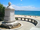
Top: Porto Salvo; Paço de Arcos Beach; middle: Palace of the Marquis of Pombal; Fort of São Lourenço do Bugio; Monsanto Tower; bottom: Royal Gardens of Caxias; São Julião da Barra Fortress | |
 | |
| Coordinates: 38°41′N 9°19′W / 38.683°N 9.317°W | |
| Country | |
| Region | Lisbon |
| Metropolitan area | Lisbon |
| District | Lisbon |
| Parishes | 5 |
| Government | |
| • President | Isaltino Morais (Ind.) |
| Area | |
• Total | 45.88 km2 (17.71 sq mi) |
| Lowest elevation | 0 m (0 ft) |
| Population (2011) | |
• Total | 172,120 |
| • Density | 3,800/km2 (9,700/sq mi) |
| Time zone | UTC+00:00 (WET) |
| • Summer (DST) | UTC+01:00 (WEST) |
| Postal code | 2784 |
| Area code | 214 |
| Patron | Nossa Senhora da Purificação |
| Website | www |
Oeiras (locally [ɔˈɐjɾɐʃ] ) is a town and municipality in the western part of Lisbon metropolitan area, located within the Portuguese Riviera, in continental Portugal. The municipality is part of the urban agglomeration of Lisbon and the town of Oeiras is about 16 km from Lisbon downtown. The population in 2011 was 172,120[1] living in an area of 45.88 km2,[2] making the municipality the fifth-most densely populated in Portugal.
Oeiras is an important economic hub, being one of the most highly developed municipalities of Portugal and Europe. It has the highest GDP per capita in the country, being also the second highest-ranking municipality (immediately after Lisbon) in terms of purchasing power as well as the second highest-ranking in the country as far as tax collection is concerned. These economic indicators also reflect the education level of its inhabitants, as Oeiras is the municipality with the highest concentration of population by tertiary education attainment in the country, their entrepreneurial prowess and the economically liberal mindset of Oeiras' society in general. It also has the lowest unemployment rate in the Lisbon area.
- ^ Instituto Nacional de Estatística
- ^ "Áreas das freguesias, concelhos, distritos e país". Archived from the original on 2018-11-05. Retrieved 2018-11-05.


