State highway in Ohio, US
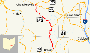
State Route 284 (SR 284, OH 284) is a north–south state highway in east central Ohio, a U.S. state. State Route 284 has its southern terminus is at State Route 83 approximately 8 miles (13 km) northeast of McConnelsville, and just 0.25 miles (0.40 km) north of the western split of the concurrency State Route 83 has with State Route 78. The northern terminus of State Route 284 is at a T-intersection with State Route 146 in the unincorporated community of Chandlersville. A portion of SR 284 is part of the Morgan County Scenic Byway.[citation needed]

