 | ||||
| Route information | ||||
| Maintained by ODOT | ||||
| Length | 6.277 mi[1] (10.102 km) | |||
| Existed | 1932[2][3]–present | |||
| Tourist routes | ||||
| Major junctions | ||||
| South end | ||||
| North end | Cass Street in Wharton | |||
| Location | ||||
| Country | United States | |||
| State | Ohio | |||
| Counties | Wyandot | |||
| Highway system | ||||
| ||||
| ||||
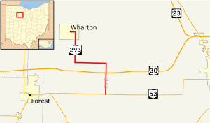
State Route 293 (SR 293) is a 6.277-mile-long (10.102 km) north–south state highway in the northwestern portion of the U.S. state of Ohio. The southern terminus of SR 293 is at SR 53 nearly one-half mile (0.80 km) south of the village limits of Kirby. Its northern terminus is at the intersection of Sandusky Street and Cass Street in Wharton. The route was designated in 1932, and was extended south in 1997.
- ^ Ohio Department of Transportation. "Technical Services DESTAPE: Wyandot County" (PDF). Archived from the original (PDF) on 2014-01-01. Retrieved 2013-12-31.
- ^ Cite error: The named reference
ODOT1931_mapwas invoked but never defined (see the help page). - ^ Cite error: The named reference
ODOT1932_mapwas invoked but never defined (see the help page).
