 | ||||
| Route information | ||||
| Maintained by ODOT | ||||
| Length | 9.28 mi[1] (14.93 km) | |||
| Existed | 1955–present | |||
| Major junctions | ||||
| South end | ||||
| North end | ||||
| Location | ||||
| Country | United States | |||
| State | Ohio | |||
| Counties | Lawrence | |||
| Highway system | ||||
| ||||
| ||||
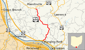
State Route 650 (SR 650) is a north–south state highway in the southern portion of Ohio. Its southern terminus is at U.S. Route 52 in Hanging Rock. From this point, the route heads northward to the community of Pine Grove in Wayne National Forest. Its northern terminus is at State Route 522 approximately 9 miles (14 km) southeast of Wheelersburg.
- ^ Ohio Department of Transportation. "Technical Services Straight Line Diagrams - SR 650" (PDF). Retrieved January 22, 2014.
