Ohiopyle, Pennsylvania | |
|---|---|
 Ohiopyle Falls on the Youghiogheny River | |
| Etymology: Lenape ahi opihəle, "it turns very white" | |
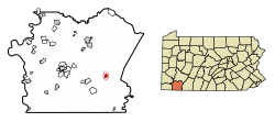
 Location in Fayette County, Pennsylvania | |
| Coordinates: 39°52′5″N 79°29′35″W / 39.86806°N 79.49306°W | |
| Country | United States |
| State | Pennsylvania |
| County | Fayette |
| Established | 1868 |
| Government | |
| • Mayor | Mark McCarty |
| Area | |
• Total | 0.50 sq mi (1.29 km2) |
| • Land | 0.42 sq mi (1.08 km2) |
| • Water | 0.08 sq mi (0.21 km2) |
| Population | |
• Total | 37 |
| • Density | 88.52/sq mi (34.18/km2) |
| Time zone | UTC-5 (EST) |
| • Summer (DST) | UTC-4 (EDT) |
| Area code | 724 |
Ohiopyle is a borough in Fayette County, Pennsylvania, United States. The population was 38 at the 2020 census.[3] While Ohiopyle has a tiny year-round population, it is often filled with tourists on the weekend, who come for the outdoor recreation opportunities at the surrounding Ohiopyle State Park, as well as the Great Allegheny Passage bicycle trail which connects with the Chesapeake and Ohio Canal towpath trail to form a continuous 335-mile off-road trail from Pittsburgh, Pennsylvania to Washington, D.C. The borough of Ohiopyle is served by the Uniontown Area School District.
- ^ "ArcGIS REST Services Directory". United States Census Bureau. Retrieved October 12, 2022.
- ^ Cite error: The named reference
USCensusDecennial2020CenPopScriptOnlywas invoked but never defined (see the help page). - ^ Bureau, US Census. "City and Town Population Totals: 2020—2021". Census.gov. US Census Bureau. Retrieved July 24, 2022.
{{cite web}}:|last1=has generic name (help)


