Ojuelos de Jalisco | |
|---|---|
Municipality and Town | |
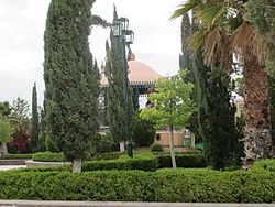
 Plaza de Armas | |
 Location of the municipality in Jalisco | |
| Coordinates: 21°52′N 101°35′W / 21.867°N 101.583°W | |
| Country | |
| State | Jalisco |
| Garrison built | 1569 |
| Government | |
| • Mayor / Presidente Municipal | Marco Antonio Jasso Romo |
| Area | |
| • Total | 1,156.71 km2 (446.61 sq mi) |
| Population (2010) | |
| • Total | 30,097 |
| Time zone | UTC-6 (Central Standard Time) |
| • Summer (DST) | UTC-5 (Central Daylight Time) |
| Postcode | 47540 |
| Area code | 496 |
Ojuelos de Jalisco is a town and municipality in the state of Jalisco, Mexico. The town's 1990 population was 7,265,[1] although by the year 2010 it had increased to 11,881.[2]
It sits at the junction of Mexico Highways 51, 70, and 80. The municipality is located in the North-Central region of Mexico. It is bordered by 3 states: Guanajuato, Zacatecas and Aguascalientes. Also, it is located in close proximity to the state of San Luis Potosi. All of the above makes of Ojuelos one of the municipalities with the most borders in Mexico. It also borders with the Lagos de Moreno municipality in the state of Jalisco.

