30°41′15″N 86°35′33″W / 30.68750°N 86.59250°W
Okaloosa County | |
|---|---|
 The Okaloosa County courthouse in March 2008 | |
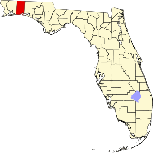
 Location within the U.S. state of Florida | |
 Florida's location within the U.S. | |
| Coordinates: 30°41′15″N 86°35′33″W / 30.6875°N 86.5925°W | |
| Country | |
| State | |
| Founded | September 7, 1915 |
| Seat | Crestview |
| Largest city | Crestview |
| Area | |
| • Total | 1,082 sq mi (2,800 km2) |
| • Land | 930 sq mi (2,400 km2) |
| • Water | 152 sq mi (390 km2) 14.0% |
| Population (2020) | |
| • Total | 211,668 |
| • Estimate (2023) | 218,464 |
| • Density | 200/sq mi (76/km2) |
| Time zone | UTC−6 (Central) |
| • Summer (DST) | UTC−5 (CDT) |
| Congressional district | 1st |
| Website | www |
Okaloosa County is a county located in the northwestern portion of the U.S. state of Florida, extending from the Gulf of Mexico to the Alabama state line. As of the 2020 census, the population was 211,668.[1] Its county seat is Crestview.[2] Okaloosa County is included in the Crestview-Fort Walton Beach-Destin, FL Metropolitan Statistical Area.
- ^ Cite error: The named reference
2020 Censuswas invoked but never defined (see the help page). - ^ "Find a County". National Association of Counties. Archived from the original on May 31, 2011. Retrieved June 7, 2011.

