 | ||||
| Route information | ||||
| Maintained by ODOT | ||||
| Existed | c. 1931–present | |||
| Section 1 | ||||
| Length | 72.7 mi[1] (117.0 km) | |||
| South end | ||||
| Major intersections | ||||
| North end | Blaine–Custer county line | |||
| Section 2 | ||||
| Length | 105.9 mi[2][3] (170.4 km) | |||
| South end | ||||
| Major intersections | ||||
| North end | Kansas state line | |||
| Location | ||||
| Country | United States | |||
| State | Oklahoma | |||
| Highway system | ||||
| ||||
| ||||
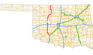
State Highway 58 (abbreviated SH-58) is the name of two state highways in Oklahoma. One of them runs for 72.7 miles (117.0 km) from Medicine Park to the Blaine–Custer County line near Hydro,[1] and the other connects US-270/281/SH-3/33 to the Kansas state line, a length of 105.9 mi (170.4 km).[3] The northern section has one lettered spur route, SH-58A.
SH-58 was originally a part of US-164. When US-164 was decommissioned in 1930, a section of the road in Major County that was left without a designation became SH-58. Since then, the highway has grown toward both the north and the south. With the designation and extension of the southern section of the highway, SH-58 is present in five counties in the western part of the state.
