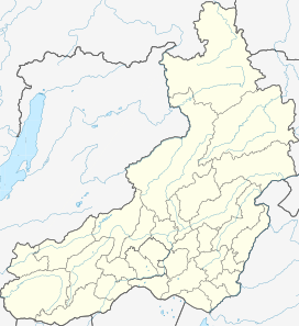
| Olyokma-Stanovik | |
|---|---|
| Олёкминский Становик | |
 Olyokma-Stanovik ONC chart section | |
| Highest point | |
| Peak | Golets Kropotkin |
| Elevation | 1,908 m (6,260 ft) |
| Coordinates | 53°43′39″N 117°33′29″E / 53.72750°N 117.55806°E |
| Dimensions | |
| Length | 400 km (250 mi) NE/SW |
| Width | 250 km (160 mi) SE/NW |
| Geography | |
| Country | Russia |
| Krai | Zabaykalsky Krai |
| Range coordinates | 53°43′N 117°33′E / 53.717°N 117.550°E |
| Parent range | South Siberian System |
| Geology | |
| Orogeny | Alpine orogeny |
| Rock age | Late Archean |
| Rock type | Granite |
| Climbing | |
| Easiest route | From Itaka, Tupik or Gulya |
The Olyokma-Stanovik (Russian: Олёкминский Становик; Olyokminsky Stanovik) is a system of mountain ranges in Zabaykalsky Krai, Russia.[1] The western end of the range reaches into Amur Oblast.[2][3]
- ^ "Олёкминский становик, нагорье" [Olyokma-Stanovik, Highlands] (in Russian). Энциклопедия Забайкалья. Retrieved 9 November 2021.
- ^ Cite error: The named reference
GЕwas invoked but never defined (see the help page). - ^ Олёкминский Становик / Great Soviet Encyclopedia: in 30 vols. / Ch. ed. A.M. Prokhorov. - 3rd ed. - M. Soviet Encyclopedia, 1969-1978.
