Onondaga, New York | |
|---|---|
Town | |
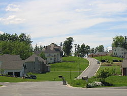
 An upscale neighborhood in the hills of Onondaga just outside Syracuse | |
 Location in Onondaga County and the state of New York. | |
| Coordinates: 42°58′41″N 76°11′54″W / 42.97806°N 76.19833°W | |
| Country | United States |
| State | New York |
| County | Onondaga |
| Government | |
| • Type | Town Board |
| • Town Supervisor | John P. Mahar |
| • Town Councilors | Kathy Fedrizzi, Lisa Goodwin, Mary K. Ryan, John Wheatley |
| Area [1]
Town of Onondaga | |
• Total | 65 sq mi (149.80 km2) |
| • Land | 65 sq mi (149.55 km2) |
| • Water | 0.10 sq mi (0.25 km2) |
| Elevation | 1,033 ft (315 m) |
| Population (2020) | |
• Total | 22,937 |
| • Density | 350/sq mi (150/km2) |
| Time zone | UTC-5 (Eastern (EST)) |
| • Summer (DST) | UTC-4 (EDT) |
| ZIP code | 13215 |
| Area code | 315 |
| FIPS code | 36-54958 |
| GNIS feature ID | 0979311 |
| Website | Town website |
Onondaga is a town in Onondaga County, New York, United States, encompassing 65 square miles. As of the 2020 Census, the population was 22,937. The town is named after the native Onondaga tribe, part of the Iroquois Confederacy. Onondaga was incorporated April 2, 1798, and is located southwest of the city of Syracuse, which it borders. The villages and hamlets which make up the town are: Cedarvale, Howlett Hill, Navarino, Nedrow, Onondaga Hill, Sentinel Heights, South Onondaga, Southwood, Split Rock, and Taunton.
- ^ "2016 U.S. Gazetteer Files". United States Census Bureau. Retrieved July 5, 2017.