Orleans, Massachusetts | |
|---|---|
 Orleans Town Hall | |
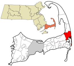
 Location in Barnstable County and the state of Massachusetts. | |
| Coordinates: 41°47′23″N 69°59′25″W / 41.78972°N 69.99028°W | |
| Country | United States |
| State | Massachusetts |
| County | Barnstable |
| Settled | 1693 |
| Incorporated | 1797 |
| Government | |
| • Type | Open town meeting |
| Area | |
• Total | 22.7 sq mi (58.7 km2) |
| • Land | 14.1 sq mi (36.6 km2) |
| • Water | 8.5 sq mi (22.0 km2) |
| Elevation | 60 ft (18 m) |
| Population (2020) | |
• Total | 6,307 |
| • Density | 446/sq mi (172.3/km2) |
| Time zone | UTC−5 (Eastern) |
| • Summer (DST) | UTC−4 (Eastern) |
| ZIP Code | 02653 |
| Area code | 508 |
| FIPS code | 25-51440 |
| GNIS feature ID | 0618257 |
| Website | www |
Orleans (/ɔːrˈliːnz/ or-LEENZ) is a town in Barnstable County, Massachusetts, United States, situated along Cape Cod. The population was 6,307 at the 2020 census.[1]
For geographic and demographic information on the census-designated place Orleans, please see the article Orleans CDP.
- ^ "Census - Geography Profile: Orleans town, Barnstable County, Massachusetts". U.S. Census Bureau. Retrieved October 6, 2021.

