Os Municipality
Os kommune | |
|---|---|
 View of Osøyro | |
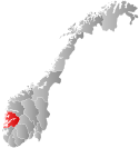
 Hordaland within Norway | |
 Os within Hordaland | |
| Coordinates: 60°13′37″N 05°28′33″E / 60.22694°N 5.47583°E | |
| Country | Norway |
| County | Hordaland |
| District | Midhordland |
| Established | 1 Jan 1838 |
| • Created as | Formannskapsdistrikt |
| Disestablished | 1 Jan 2020 |
| • Succeeded by | Bjørnafjorden Municipality |
| Administrative centre | Osøyro |
| Government | |
| • Mayor (2015-2019) | Marie Lunde Bruarøy (H) |
| Area (upon dissolution) | |
| • Total | 139.57 km2 (53.89 sq mi) |
| • Land | 133.48 km2 (51.54 sq mi) |
| • Water | 6.09 km2 (2.35 sq mi) 4.4% |
| • Rank | #360 in Norway |
| Population (2019) | |
| • Total | 20,152 |
| • Rank | #57 in Norway |
| • Density | 151.0/km2 (391/sq mi) |
| • Change (10 years) | |
| Demonym | Osing[1] |
| Official language | |
| • Norwegian form | Nynorsk |
| Time zone | UTC+01:00 (CET) |
| • Summer (DST) | UTC+02:00 (CEST) |
| ISO 3166 code | NO-1243[3] |
Os is a former municipality in the old Hordaland county, Norway. It was located in the Midhordland region, just south of Norway's second-largest city, Bergen. Due to its proximity to Bergen, Os experienced strong population growth.[4] The administrative centre (and commercial centre) of Os was the village of Osøyro. It is the largest settlement in the municipality, with over 60% of the municipal residents living here. Other large villages in Os included Hagavik, Halhjem, Søfteland, Søre Øyane, and Søvik. On 1 January 2020, the municipality became part of Bjørnafjorden Municipality in Vestland county.
Prior to its dissolution in 2020, the 140-square-kilometre (54 sq mi) municipality is the 360th largest by area out of the 422 municipalities in Norway. Os is the 57th most populous municipality in Norway with a population of 20,152. The municipality's population density is 151 inhabitants per square kilometre (390/sq mi) and its population has increased by 29.2% over the last decade.[5]
- ^ "Navn på steder og personer: Innbyggjarnamn" (in Norwegian). Språkrådet.
- ^ "Forskrift om målvedtak i kommunar og fylkeskommunar" (in Norwegian). Lovdata.no.
- ^ Bolstad, Erik; Thorsnæs, Geir, eds. (26 January 2023). "Kommunenummer". Store norske leksikon (in Norwegian). Kunnskapsforlaget.
- ^ Os kommune i Hordaland (Os municipality)
- ^ Statistisk sentralbyrå (2017). "Table: 06913: Population 1 January and population changes during the calendar year (M)" (in Norwegian). Retrieved 5 January 2018.
