Otay Mesa, San Diego | |
|---|---|
| Otay Mesa | |
| Coordinates: 32°33′30″N 116°56′33″W / 32.5583913°N 116.9425228°W | |
| Country | |
| State | |
| County | |
| City | |
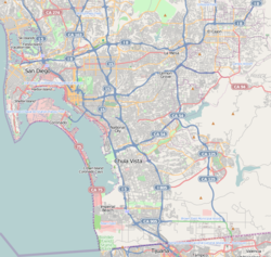
Otay Mesa (/ˈoʊtaɪ ˈmeɪsə/ OH-ty MAY-sə) is a community in the southern exclave of San Diego, California, just north of the U.S.–Mexico border.
It is bordered by the Otay River Valley and the city of Chula Vista on the north; Interstate 805 and the neighborhoods of Ocean View Hills and San Ysidro on the west; unincorporated San Diego County on the north and east including East Otay Mesa and the San Ysidro Mountains; and the Otay Centenario borough of Tijuana, Mexico on the south.
Major thoroughfares include Otay Mesa Road/California State Route 905, Otay Valley Road/Heritage Road, Siempre Viva Road, and California State Route 125. Otay Mesa is the second-least walkable neighborhood of San Diego.[1]
- ^ "Otay Mesa neighborhood in San Diego". Walk Score.
