Otisville, New York | |
|---|---|
 Main Street, Otisville in 2022 | |
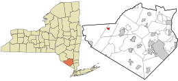
 Location in Orange County and the state of New York. | |
| Coordinates: 41°28′N 74°32′W / 41.467°N 74.533°W | |
| Country | United States |
| State | New York |
| County | Orange |
| Area | |
| • Total | 0.76 sq mi (1.98 km2) |
| • Land | 0.76 sq mi (1.98 km2) |
| • Water | 0.00 sq mi (0.00 km2) |
| Elevation | 853 ft (260 m) |
| Population (2020) | |
| • Total | 969 |
| • Density | 1,268.32/sq mi (489.59/km2) |
| Time zone | UTC-5 (Eastern (EST)) |
| • Summer (DST) | UTC-4 (EDT) |
| ZIP code | 10963 |
| Area code | 845 |
| FIPS code | 36-55673 |
| GNIS feature ID | 0959548 |
Otisville is a village in Orange County, New York, United States. The population was 969 at the 2020 census. It is part of the Poughkeepsie–Newburgh–Middletown, NY Metropolitan Statistical Area as well as the larger New York–Newark–Bridgeport, NY-NJ-CT-PA Combined Statistical Area.
The village of Otisville is in the town of Mount Hope, located near the western town line.
The mayor of Otisville is Brian Carey.[2][3]
The name "Otisville" also refers to Federal Correctional Institution, Otisville and Otisville Correctional Facility, a state prison, both located nearby. There is also the station on Metro-North's Port Jervis Line.
- ^ "ArcGIS REST Services Directory". United States Census Bureau. Retrieved September 20, 2022.
- ^ Nani, James (March 15, 2013). "3 vying for Otisville mayor job". Times Herald-Record.
- ^ "2015 Village Election Results". Times Herald-Record. March 18, 2015.
